
Data.wa.gov.au exists to help you to easily discover, explore, and visualise data from all over Western Australia. Thanks to advances in web and mobile technologies the ability to easily see and visualise data is easier than it has ever been.
In the realms of geospatial and scientific datasets it used to be necessary to purchase or download complex software packages, to even be able to look at a dataset, and often requiring training to use effectively. Tabular datasets (e.g. spreadsheets) may have been easy to look at in their raw form but doing any meaningful visualisation beyond simple plots in Excel was a challenge.
This article will guide you through ways you can get started with visualising different types of data in no more than 5 minutes through easy to use web-based tools.
Geospatial Data
Western Australian data
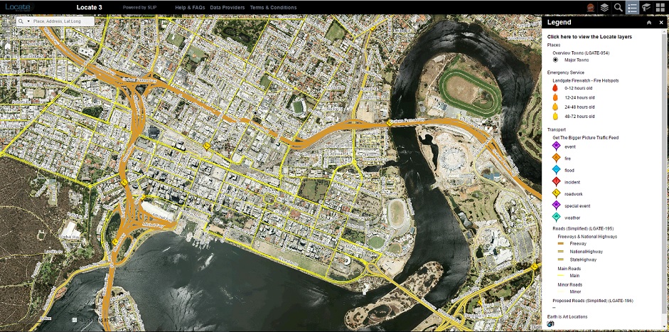
Locate
Locate is a public map viewer that showcases Western Australia’s location based data and information. It gives you the flexibility to overlay aerial photography and other property related information available. Information such as roads, public transport routes, historical maps, census data, schools and health facilities can be turned on and off at the click of a button. Locate has incorporated information from many government sources from across the state.
Data.wa.gov.au Showcases
We've collected together the best examples of datasets in use, to provide further insight, ideas, and inspiration. Many of these showcases provide easy access to visualisation and further insights from data - for example the WA Marine Map and the PlanWA public mapping website.
Visit Data.wa.gov.au's Showcases
If you're using data in an innovative, insightful, or useful way and would like to have you worked listed please get in touch. A showcase could be anything - an app, website, data visualisation, article, blog, or report. See Showcasing your use of data for more information.
Federal, State, and Local government data
NationalMap is a website for map-based access to spatial data from Australian government agencies, and
- provides easy access to authoritative and other spatial data to government, business and the public
- facilitates the opening of data by federal, state and local government bodies
- provides an open framework of geospatial data services that supports commercial and community innovation